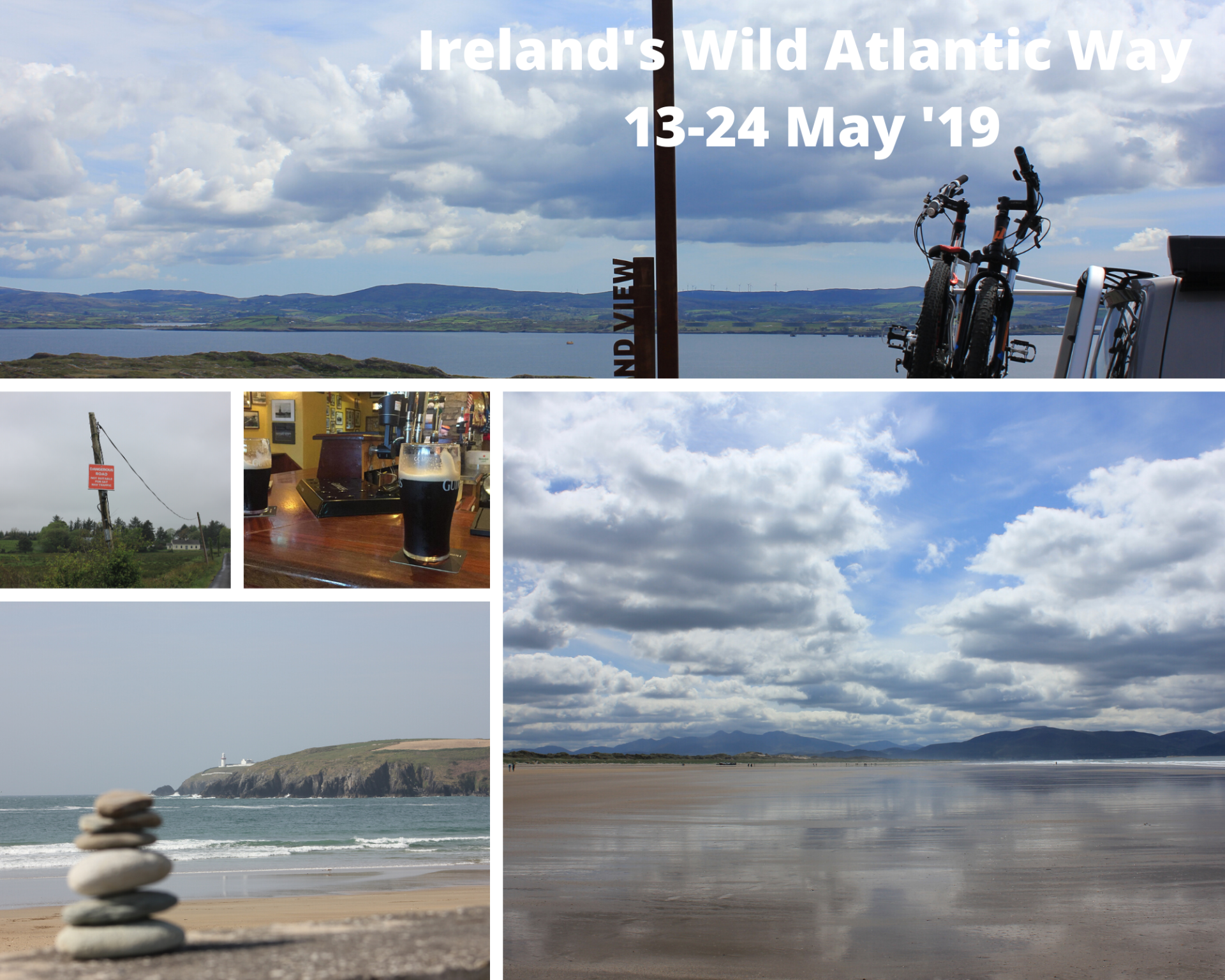
Blog Layout

Ruta del Cares

John Swift • Jul 22, 2021

The iconic trek from Asturias to Leon

Having lost the opportunity to explore the Picos de Europa in 2020 due to an issue with the van seeing it sent homeward on the back of a lorry, we’ve been keen to get back and see what we’ve missed.

Top of the list was the 10km path above the Cares river between Poncebos and Cain, through a gorge known as Garganta del Cares, which separates the western and cental massifs of the mountain range.

History

The path was originally cut into the rock to support the creation of a hydroelectric project over 100 years ago; with the canal from Cain visible along many sections of the route, before the water descends to drive the turbines of the plant at Camarmeña near where we started.

Logistics

We were based in Potes, which meant an hour and 10 minute drive around to the start point of the walk at Poncebos. Although the roads were quiet early in the morning, the first 25km down to Panes is very narrow and winding and whilst beautiful, is a journey you don’t want to have to make in the van if it isn’t necessary.

In hindsight, we would have been better off basing ourselves in Las Arenas ahead of the walk, where there is a campsite (check) and an attractive town with bars and restaurants to explore. Another option is a free area de autocaravanna on the N621 outside Panes, but this still means a km trip to the start.

Either of these would have facilitated an earlier start to the trip, which is important, because parking was a nightmare out towards Poncebos. There is parking at the funicular which goes up to Bulnes (check) but it was already full by the time we arrived (0900) with vehicle being turned around and sent back towards a car park a few kms back towards Poncebos. We managed to get the van up off the road before the car park as we were keen to avoid any unnecessary steps before we got properly stuck into the hike.

The walk reportedly attracts 300,000 walkers a year, many of whom are concentrated in the summer months. Whilst this would normally put us off, I have to say it didn’t bother us too much on the day.

The route


After passing through a tunnel, ignore the road left towards the funicular, and carry straight on where the road will probably be barriered to vehicles, towards the start of the trail. Shortly afterwards you’ll find a shop selling souvenirs and trekking poles, and a hotel next door where we stopped for coffee.

It was along this road that we did a double take at an albeit fit and sporty couple, kitted out for a hike, whilst pushing a toddler in a rugged all-terrain type pushchair. Shortly afterwards a local guy stopped them to advise that they wouldn’t get too far and the route was unsuitable for the buggy.


The road very quickly runs out, where the path commences with a sharp right turn and the start of a steep 2km section with around 300m of ascent. The path is very rocky and uneven, and consists of numerous switch backs to take you up to where the path levels out and becomes more even to walk on.


Whilst stopping for photographs as often as possible is regularly an excuse for a sneaky breather, the views are breath-taking all along the route and are worth trying to capture, although the pictures can never fully do them justice.


The path is cut into the rock in places forming tunnels, but mainly it is a broad path, with steep drops to the gorge and no fencing, so it may not be advisable for anyone who is uncomfortable with heights. 


The crowds


The walk reportedly attracts 300,000 walkers a year, many of whom are concentrated in the summer months. Whilst this would normally put us off, I have to say it didn’t bother us too much on the day.


For the first couple of hours, it’s all one-way traffic, then about the halfway point you’ll meet folk coming the other way. A few members of a scout troop did not possess the situational awareness to appreciate how far their camping mats protruded from their rucksacks, and a couple of folk sat down for lunch in the odd sheltered spot on the trail, but the majority of walkers were conscious of the sheer drop, and the need to pass others respectfully and with care.
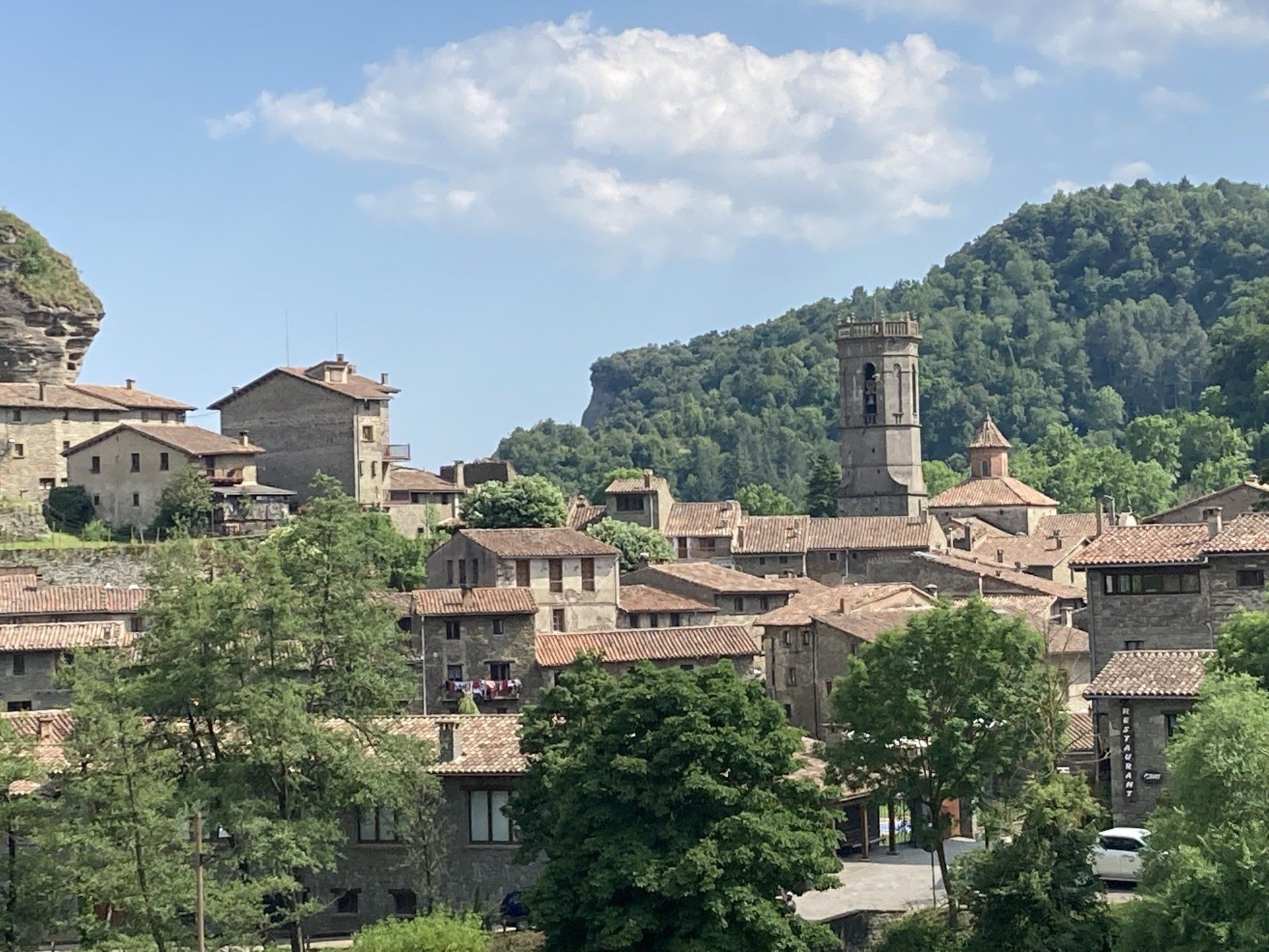


Caín


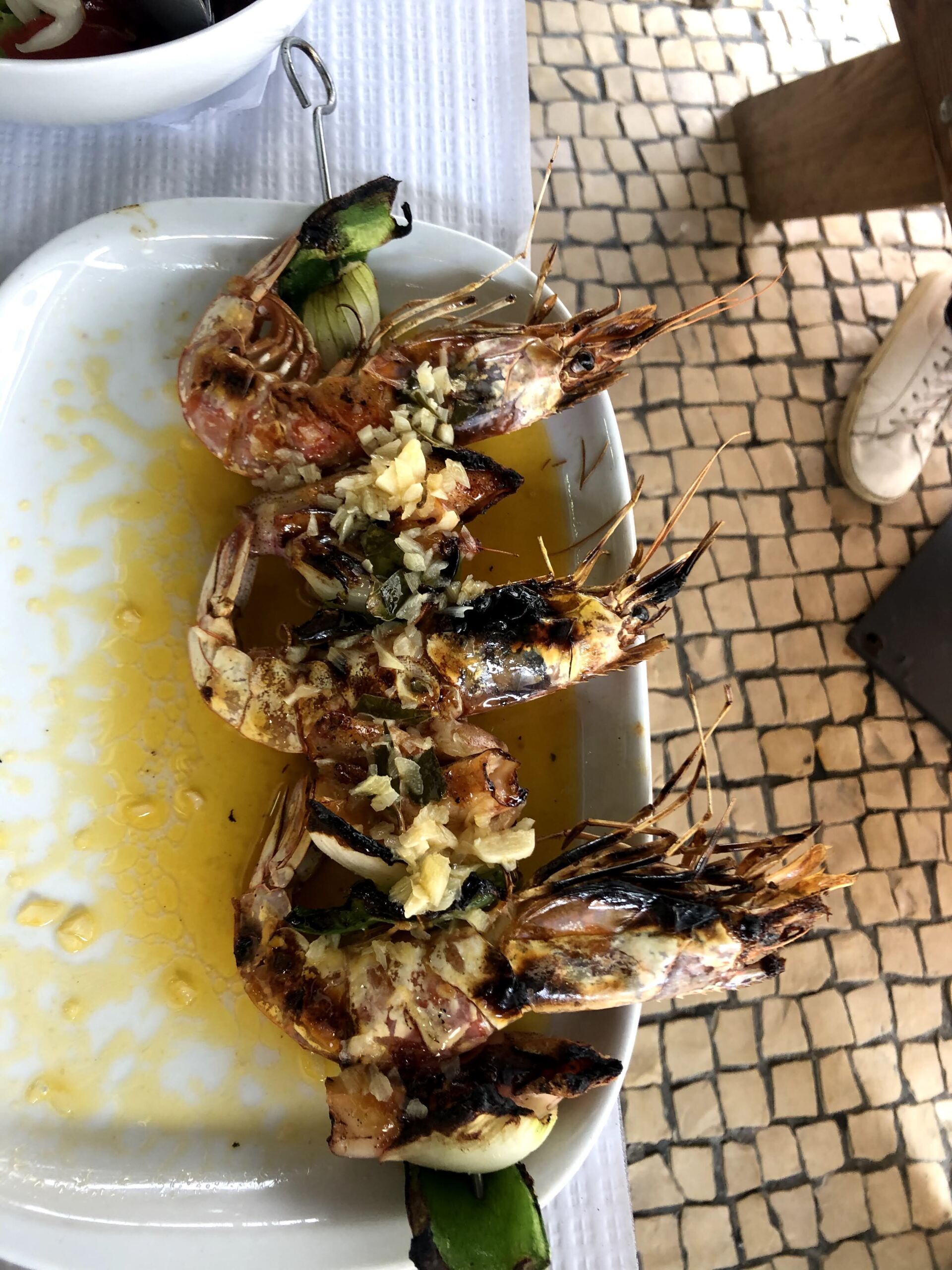
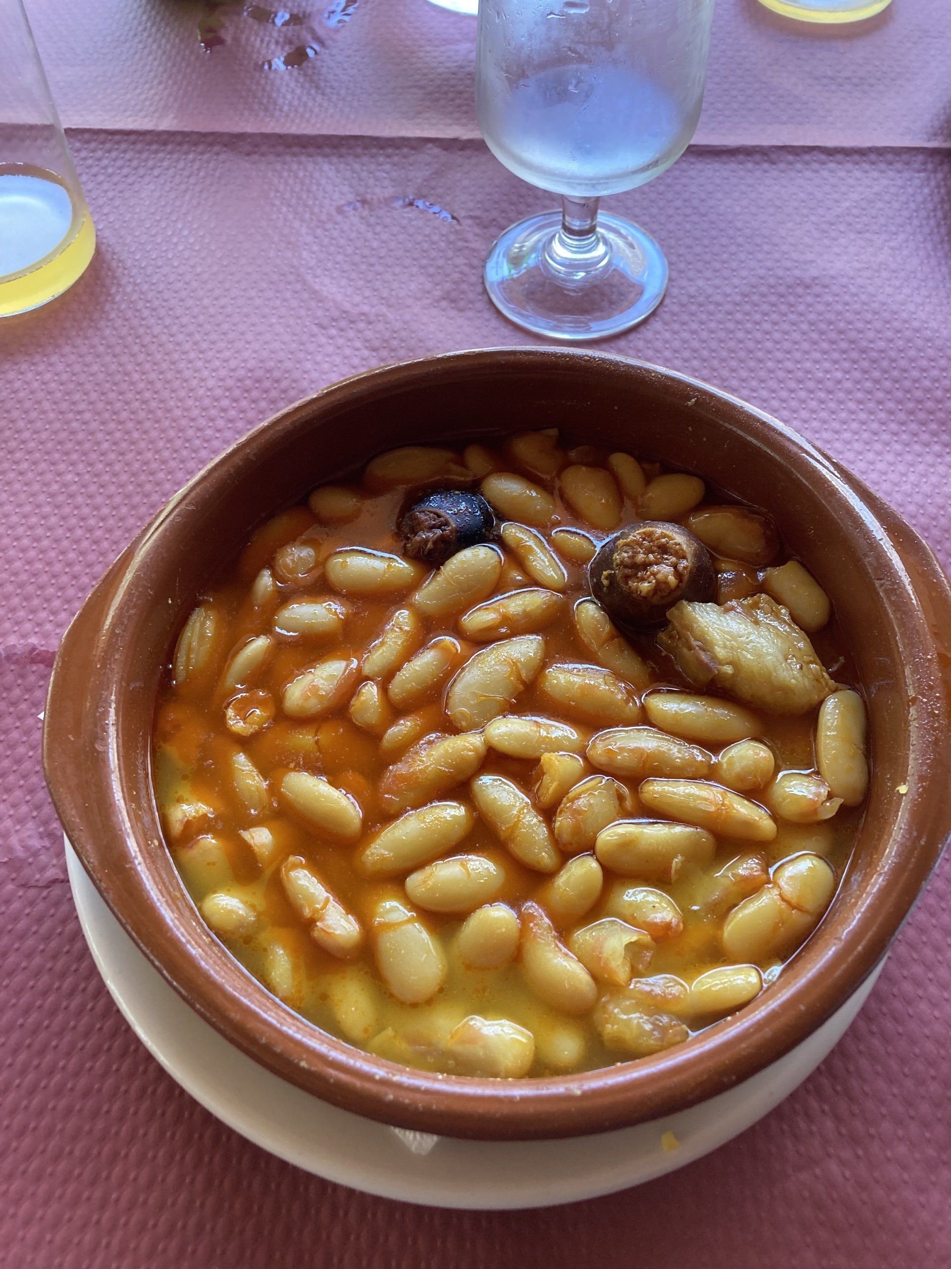
Completing the walk you will not only have traversed the Cares Gorge, but you’ll have also left the province of Asturias and arrived in the province of Leon, ending the route in the small village of Caín. Reliant on the tourist trade, the village is a collection of cafes and restaurants to refuel and revive weary travellers. 


We chose the menu de dia in Casa Tino and were not disappointed. The very friendly staff did not appear to be jaded by another throng of walkers needing fed, and served up dishes including Asturian fabas, a white bean stew flavoured with chorizo and black pudding, an excellent spaghetti bolognese, and huge salad. Just what we needed!


And then?


Well, your options are to walk back, and reviews I have read say that it is worthwhile if you have the energy, as the views that unfold from perspective of the south to north path are equally awe inspiring. 


However, taxis can be arranged to transfer you back to your transport at Poncebos, and many were waiting around the afternoon that we were in Caín.


We chose to book a 4x4 tour with Vivepicos (https://www.vivepicos.com) which saw us join six others to fill the third vehicle in a 3 landrover convey back to the start of the walk.


Our driver Jorge was very helpful in explaining the history, geology, flora and fauna of the Áliva, Valdeón and Liébana valleys, including an old wolf trap, cattle, wild horses, huge shepherd dogs and showing the fantastic views as we journeyed along, however it made for a very long day in the end, and I’m not really sure how much we were taking in, or truly appreciated during the final hour or so. That’s not a criticism of the tour, which was excellent, it’s just a consideration depending on where your day is going to start and end to ensure you get the most from it.


Thankfully, Jorge dropped everyone off at their individual vehicles around 1900, so there at least there was no more walking to do.

Share this post

by John Swift 27 Jul, 2021
Situated about 40km northwest of the city of Girona, the Collsacabra Protected Natural Area is dominated by steep crags, which along with two major reservoirs, are major attractions for lovers of the outdoors. As well as being one of the points of entry to the area, the village of Rupit has enough charm to deserve a visit even if you haven’t brought your mountain bike or walking boots. And so it was, that one Friday morning we packed up Obi for the weekend and headed for the hills. The route we took to the hills from the Costa Brava went via the village of Les Planes d'Hostoles, as the plan was to take a quick dip in one of the pools of the Riera de Cogolls, however after parking up, we saw signs advising that due to Covid, a booking was required to control the number of people at the sites at any one time. Although we didn’t think it too busy, instead of a dip we opted for a short walk nearby on the path which makes up the Catalan section of el Camino Santiago, before continuing our journey. The road into Valle d’en Bas carves through the Serrat de la Calcina mountains in a tunnel from which you emerge into a broad lush valley surrounded by imposing mountains, in contrast to the narrow valley you’ve been driving through for the previous 20 minutes. Shortly afterwards we stopped in Hostelets d’en Bas for lunch, a village that has origins going back to the 18th century with the establishment of a hostel on the Royal road between Olot and Vic. In narrow calle Teixeda, you’ll find houses with beautiful wooden balconies festooned with flowers. This street also has a number of restaurants, including the Ca L’Esteve where we enjoyed an excellent menu del dia before the heavens opened, and the friendly staff had to lend us an umbrella to make it back to where the van was parked. What seemed like a slow 30 minute drive up the mountain towards Rupit in heavy rain brought us to Camping Rupit, where we decided to sit out the showers in the bar and consider setting up camp later. The site is small, consisting of a field for tents and campers on one side of the central amenities block, with bungalows and fixed tents on the other. There is a bar/ restaurant and small shop, and on that Friday evening, we practically had the place to ourselves. Eventually the rain stopped, and we set up camp and admired the views of the surrounding hills.
by John 13 Aug, 2020
Synonymous with the production and export of Port, the cities possess numerous historic sites, an abundance of interesting transport options, and plenty of places to eat and drink. Based on five nights in August 2020, here are our top tips to enjoy a stay in these beautiful cities. 1 Ditch the van Controversial I know for a blog on a campervan site, but the streets of Porto and Gaia Nova are unforgiving to larger vehicles and are best explored on foot. We found ample secure parking for only €6 per day at Estacion General Torres on the Gaia Nova side, only a 10-minute walk from the river. 2 Take the tram to Foz Porto has maintained three historic trams, with wooden interiors, brass fittings and ropes trailing through the interior to ring a large bell when requesting a stop. One of the routes, known as Linha 1, departs from Infante runs along the banks of the Douro River to the Passeio Alegre Park in the Foz. Take the time to watch the driver change the direction of the tram at the end of the route by swapping their seat from one end to the other, flipping the passenger seats, and swinging the electrical pickup arm, or pantograph, from front to back.
by John 07 Jul, 2020
“So where are you going to stop first?” “Teruel” “Where?” “About an hour and a half north west of Valencia” “Oh” Which reinforces why the locals felt the need twenty years ago to start a movement called “Teruel Existe” to campaign for an improvement in services and infrastructure for what they felt was a forgotten part of the country. At the time the city and region were served by a single track, non-electrified railway line, and no motorways. Thankfully, things are much better today with A-roads linking the city to both Zaragoza and Valencia, and Madrid only an hour away by high speed rail line. However, despite the improved transport links, and the numerous sights and distractions in and around the city, you’ll still find surprisingly few tourists. Teruel city Many of the buildings in Teruel are fine examples of the Mudéjar style, the name given to the application of elements derived from Islamic arts to traditional European architecture. These include the Cathedral and Torre de el Salvador, and the more modern but no less ornate La Escalinata, connecting the railway station with the main part of the town.
by John Swift 03 Jul, 2020
County Clare In order to make up for some of the lost time - or maybe a better way to describe it would be the 'extra time well spent' - we decided to take the ferry from Tarbert straight to Killimer in Co. Clare (sorry Co. Limerick!). We made a short stop in beautiful Spanish Point, so named for a number of ships of the Spanish Armada that were wrecked off the coast here in 1588, and then, even though we hadn't planned on stopping in Lahinch, we ended up "losing" more time here as we couldn't resist sampling some of the offerings from the Western Herd Brewing Company from nearby Kilclogher. Recently established by a local brother and sister team and with a master brewer brought all the way from Chicago, these guys hit the ground running with four main brews: a pale ale, a red ale, an IPA and a Belgian style witbier. The IPA in particular was one of our favourites so far! They also have a session IPA and a vanilla porter. To Hell or to Connacht! From Munster into Connacht, the "most Irish" of the four provinces. They're all Irish of course but in the mid-1600s, after yet another failed rebellion against English rule, many Irish landowners had their property confiscated during the subsequent Cromwellian Plantation and some were even shipped to the Caribbean as indentured servants. Of those who remained many were removed to west of the River Shannon as it was deemed safer by the English to keep them contained between the broad Shannon and the Atlantic ocean, thus giving rise to the expression "To Hell or to Connacht"! Today there are more Irish speakers here than in any other province and it is renowned for its traditional music scene - and, of course, its pubs!
by John Swift 03 Jul, 2020
Navigating Ireland’s Wild Atlantic Way one microbrewery at a time - May 2019
by John Swift 03 Jul, 2020
En route, road signs reminded us that our destination’s official name is the Dutch language “Ieper”, whilst the French “Ypres” is more commonly known; however we discovered whilst there, it was also known as “Wipers” by the British troops stationed there in the “Great War”, but more about that later. Fortifications around the town existed for over a thousand year, with successive occupiers and conquerors providing additional ramparts and moats to protect its strategic position. For a large part of World War 1, Ypres was surrounded by German forces on three sides, from where it was heavily bombarded resulting in extensive destruction. Camping Jeugdstadion The municipality run Camping Jeugdstadion is perfectly situated to enjoy Ypres and the surrounding area. On foot it’s only 5 minutes to the city walls, 15 mins to both the Menin Gate, and the Grote Markt, the central square with its famous Cloth Hall. The site is well equipped with two amenity blocks, recycling and electricity and water points, a field for camping, cabins for rent and a hardened grass area for campervans and caravans. We used one of the additional concrete plots for campers and mobile homes, where their website states that awnings aren’t allowed, however the super friendly staff were very chilled about us putting ours out onto the adjacent grass area. It is possible to hire bikes from the site, and whilst slightly better rates may have been available elsewhere in the city, the convenience was hard to beat. Menin Gate and last post ceremony Between 1914 and 1918, hundreds of thousands of men marched through the Menin Gate on their way to the battlefields. The location was therefore chosen as one of the four sites to commemorate members of the Commonwealth forces with no known grave. The grand arch of the gate and its surrounding structure are covered in stone slabs, into which are carved the names of over 54,000 men. Shortly after the memorial was inaugurated in 1928, the buglers of the local Fire Brigade played the Last Post as an expression of gratitude by Belgian nation towards those who had died. The tradition continues to this day, and can be seen every evening at 8pm. People start to gather from 7pm, and traffic is stopped around 30 minutes later, so I’d recommend getting there early enough to gather within the arches of the gate itself to fully appreciate this moving and atmospheric event. The night we were there included wreath laying by UK veterans and schoolkids, and bagpipe music from a very nervous teenage piper who we found ourselves offering words of calm and reassurance to whilst waiting for the ceremony to start. He didn’t have to worry as he was fantastic. Grote Markt The central square known as the Grote Markt is surrounded by shops, restaurants and the Cloth Hall, which is also home to the In Flanders Fields museum. The museum provides displays explaining how the battles unfolded around the city, how soldiers lived in the trenches, and capturing the scale and senselessness of the loss of life. Although a difficult subject matter, this museum is a must during any visit to Ypres.
by John Swift 30 Jun, 2019
Just outside Leuven, the Belgian village of Werchter has hosted a music festival every year since 1976.
Show More
Share by: